Welcome to the trench
Whats New
Search the Site!!
For Sale
Guest Book
The Kaisers Cross
The Raiders
In the Trenches
Mobile warfare
The Casualties
The Battles
Verdun
The German Army
The Weapons
The Croix de Guerre
The Men
Letters
The Wars in Africa
Harry's Africa
Stars and Hearts
French Colonial Awards
GSWA History 1914-15
The Boer war
British Groups
Forum
Research Links
texts
Diary
Assorted maps
GrSchlacht1
GrSchlacht2
GrSchlacht3
On the Lys
Njemen-Armee 1915
Brussilow early
Brussilow late
Souville Nase
Bweho
Cameroon 1914
Avocourt raid
Verdun AEF
Verdun South
Verdun South Details
December16verdun
89 maps
neu
Demuin
Whats New to end mar
OOBs


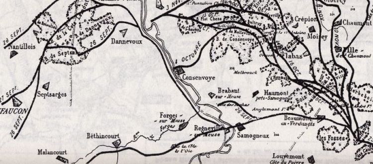
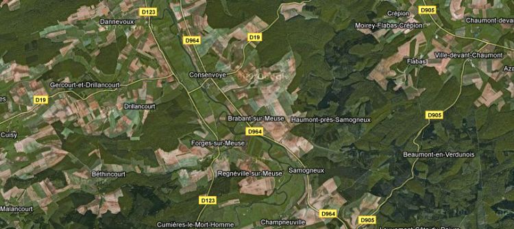
The following map and satelite view from Google maps shows the area fought in by the 104th Field Artillery. In the South West corner, just off the map are the infamous Height 304 and "Dead Man". Important for the section on Major Seymour and the 104th Field artillery are the area from Bethincourt to Dannevoux in a progression from South to North on the West bank, then the West to East progression on the East bank. The river runs diagnolly through the middle of the map.

To continue to the page on Major Seymours unit click HERE

The Forges River mentioned in the text runs from Malancourt-Bethingcourt-Forges.

 
Top